Pictures and Photos of Canada
Aerial Pictures
(There are 71 photos in this photo gallery.)
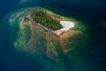
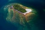
Island Forest Lake Superior Ontario
A tiny forest clad island sits like an oasis in the cool blue waters of Lake Superior in Ontario, Canada. The island appears to emerge from the depths of the lake on angled slabs of rock.
Surrounded by the beautiful blue waters of Lake Superior in Ontario, Canada, a small island is furnished by a lush forest. Aerial view of small rocky Islands with a clear view through the water to the rocks below in Lake Superior during a flight ...
Night Sky Broughton Strait Northern Vancouver Island
Islands are silhouetted while the waterways known as the Broughton Strait and Queen Charlotte Strait shine like silver against the bright night sky seen off the coast of Northern Vancouver Island, Canada.
A clear night reveals views across the Broughton Strait and the larger Queen Charlotte Strait towards the coast mountains of British Columbia. The night sky is illuminated by the setting sun off on the horizon. View over Northern Vancouver Island with Alert Bay ...
Broughton Archipelago Sunset Northern Vancouver Island
The coast mountains of the British Columbia mainland is bathed in the soft hues of sunset as the scattered islands of the Broughton Archipelago and shores of the Northern Vancouver Island are silhouetted.
Sunset aerial view looking from Vancouver Island over the Broughton Archipelago towards the large British Columbia Coast Mountains, British Columbia, Canada.
Kaministiquia River Waterfall Aerial Ontario
An impressive aerial view of the Kaministiquia River and Kakabeka Falls waterfall in Ontario, Canada. The Waterfall is situated in the Kakabeka Falls Provincial Park near Thunder Bay.
The Kaministiquia River was one of the most important water routes for Canadian fur traders wanting to travel to western Canada from the Great Lakes. Imagine paddling up stream then coming across Kakabeka Falls - the largest falls in the Lake Superior ...
Marys Harbour Aerial Newfoundland Labrador
An aerial view of the residential houses, businesses and roadway which encircles the banks of Mary's Harbour in Southern Labrador in Newfoundland Labrador, Canada.
Taking a tour by air around Southern Labrador in Newfoundland Labrador, Canada lets one capture the aerial views of the landscape. The town of Mary's Harbour is easy to access by roadways, which has become a fairly recent addition, by air and by ...
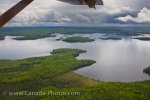
Aerial View wilderness lakes Northern Ontario
An aerial view from a De Havilland DHC-3 Otter aircraft shows wilderness lakes, islands and the forest in Northern Ontario.
An aerial view of wilderness lakes from a De Havilland DHC-3 Otter aircraft. The view shows the lake, islands and forest of Northern Ontario. The view is seen from the side of the aircraft under its wing. Large dark puffy clouds hang over the horizon ...
Coal Pit Thunder Bay Ontario
An aerial view of the Thunder Bay coal pit on the shores of Lake Superior.
Along the shores of Lake Superior is a coal pit in the city of Thunder Bay. This aerial view shows the coal plant in the black pit. Cars are parked along the side of the pit. Coal Pit on the shores of Lake Superior in the city of Thunder Bay, Ontario, Canada.
Thunder Bay Marina Waterfront Ontario
An aerial view shows several boats docked at the marina along the waterfront in the city of Thunder Bay.
The waterfront has several boats docked at the marina in Thunder Bay. The aerial view shows the city of Thunder Bay with its many buildings and roads lead to the waterfront on Lake Superior. A few trees are scattered among the city and the marina. Marina and waterfront i ...
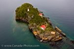
Shaganash Island Lighthouse Lake Superior
On Lake Superior is the Shaganash Island and its lighthouse.
The small Shaganash Island is full of lush trees with a clear area for the island's lighthouse. The charming Shaganash Island Lighthouse is a charming white building with a red dome. Lake Superior surrounds the small rocky island. Shaganash Isla ...
Aerial Of Canyon Near Thunder Bay
An aerial view shows lush green forest in a canyon near Sleeping Giant Provincial Park and Thunder Bay in the background.
An aerial view shows water flowing through a canyon with surrounding lush green trees. Thunder Bay and the Sleeping Gian Provincial Park sit in the distance of the canyon. Thunder Bay sits along the northern shores of Lake Superior, part of the Great Lakes. Th ...
Kakabeka Falls Kaministiquia River Aerial View
An aerial view of the amazing Kakabeka Falls along the Kaministiquia River.
This amazing aerial view of the Kakabeka Falls Provincial Park shows the foamy misty waters cascading down into the Kaministiquia River. The power of the water can be seen from this view. A bridge spans the river just before the falls. Lush evergreen surround the area of the l ...
Aerial Trowbridge Island Lighthouse Lake Superior
An aerial view shows Lake Superior surrounding the rocky Trowbridge Island and the lighthouse that was built in 1910.
The lighthouse sits high on the rocky island of Trowbridge. A couple of houses with red roofs sit among the rocks and trees of the island. Under the water's surface you can see the larger rock formations of the island. This aerial view of Trowbri ...
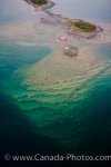
Islands Lake Superior
An aerial view of Lake Superior reveals layers of rock beneath the small island.
Beautiful clear waters of Lake Superior shows a revealing view of the layers of rock below the small island. The surface of the island has dense population of lush green trees. This aerial view shows the small island and its continuing rocky layers below the w ...
Freight Ship Docked At Thunder Bay
An aerial view shows a large freight ship in dry dock at the Thunder Bay waterfront.
Thunder Bay's waterfront has a large freight ship in dry dock. The aerial view shows how large the freight ship is to the surrounding buildings and boats. This aerial view shows the coast line of Thunder Bay and the industrial town. Thunder Bay sits along th ...
Shipwrecks On Coastline Of Lake Superior
An aerial view of a shipwreck along Lake Superior's coastline near Thunder Bay.
Parts of a shipwreck lays along the coastline of Lake Superior. An aerial view shows the ship's parts at the shallow water surface. Two sections of the ship can be seen in the dark waters of Lake Superior. The shipwreck is near Thunder Bay, Ontar ...
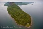
Sleeping Giant Provincial Park Peninsula Ontario
An aerial view shows Lake Superior surrounds the lush green Sleeping Giant Provincial Park on the Sibley Peninsula near Thunder Bay.
This aerial view shows Sleeping Giant Provincial Park on the Sibley Peninsula in Lake Superior. This lush green park is surrounded by the calm waters of Lake Superior. The name of the park is given due to the rock formations that look like a giant is asleep on ...
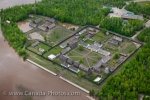
Aerial Fort William Historical Park Thunder Bay
On the bank of the Kaministiquia River is Fort William Historical Park after a spring flood.
An aerial view of Fort William Historical Park after a spring flood. The historical park sits on the Kaministiquia River in the city of Thunder Bay. Fort William Historical Park is a reconstruction of the Fort William fur trade post in 1815. Buildings sit in neat ro ...
Aerial Small Rocky Islands In Lake Superior
Small rocky islands with their layers of rock below the clear water of Lake Superior.
Small rocky islands sit above the water of Lake Superior. Under the water's surface is a clear view of the layers of rocks below. An aerial view shows the layers of rocks under the water. A patch of trees sit on the small rocky islands. Aerial view of small r ...
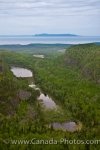
Aerial View Of Ouimet Canyon
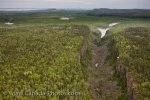
This aerial view shows the Ouimet Canyon within the vast green forest of the Ouimet Canyon Provincial Park near Thunder Bay in Ontario, Canada.
The Ouimet Canyon is surrounded by the forest of the park. The trees of the forest are different shades of green. This aerial view of the canyon also shows small bodies of water in the distance. The Ouimet Canyon is part of the Ouimet Canyon Provincial Park ...
Porphyry Point Lighthouse Aerial Lake Superior Thunder Bay
An aerial view of the picturesque region where the Porphyry Point Lighthouse sits at the entrance to Black Bay in Lake Superior near Thunder Bay, Ontario.
The aerial scenery of the Porphyry Point Lighthouse at the entrance to Black Bay on Lake Superior near city of Thunder Bay, Ontario is stunning on a clear day. The red rooftops glisten in the sunlight and one can easily identify where the drop offs are in Lake Superior especially around ...
Strait Of Belle Isle Iceberg Southern Labrador Canada
As the sunlight shines off the snow white colored iceberg, the green hues of the water take over the base as it floats around the Strait of Belle Isle in Southern Labrador, Canada.
The water starts to flow across the surface of an iceberg which floats aimlessly about in the Strait of Belle Isle in Southern Labrador during its melting process. Ice chunks slowly start to break away from this iceberg which only has a few remai ...
Highway 510 Aerial Picture Cartwright Marys Harbour Labrador
The aerial view of Highway 510 as it travels through Southern Labrador in Canada between Cartwright and Mary's Harbour.
This aerial picture shows how Highway 510 meanders across the unique landscape of Southern Labrador in Canada between Cartwright and Mary's Harbour. Highway 500 was the original route of the Trans Labrador Highway and measured 341 miles with the ...
Melting Iceberg Strait Of Belle Isle Southern Labrador
An aerial view of the beauty of a melting iceberg which has made its way to the Strait of Belle Isle in Southern Labrador in Newfoundland Labrador.
An aerial view of a large iceberg floating aimlessly in the Strait of Belle Isle in Southern Labrador in Newfoundland Labrador, Canada. This aerial pictures lets one see how a large mass of ice is slowly meting above the surface which is only a s ...
Marshlands Helicopter Tour Aerial Southern Labrador Canada
A helicopter tour over the marshlands of Southern Labrador in Newfoundland Labrador, Canada allows visitors to view the creative layout of the land.
While on a helicopter tour in Southern Labrador in Newfoundland Labrador, Canada, a unique creation of the marshlands and bogs appear below giving one a prime opportunity for a map like aerial picture. The water finds its way through the differen ...
Waterfront Properties Lake Superior Thunder Bay Ontario
An aerial view of the foot like piece of land extending into Lake Superior near Thunder Bay, Ontario where beautiful waterfront properties are located.
The land around the coastal shores of Lake Superior near Thunder Bay, Ontario stretches out into the lake where residential properties sit along the waterfront. Each of these properties have a beautiful view, their own beach and boat ramps which allows people to fully enj ...
Lake Superior Luxury Boat Thunder Bay Ontario
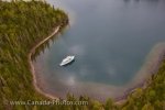
While flying overhead, a luxury boat anchors in a protected bay on Lake Superior near Thunder Bay, Ontario in Canada.
A tranquil and calm bay along the shores of one of the islands is where a luxury boat decided to anchor for a short time to enjoy the serenity of Lake Superior. A small beach runs the coastline of this island where passengers aboard this boat cou ...
Northern Ontario Aerial Scenery Ontario Canada
While chartering a flight from Red Lake, Ontario in Canada, the aerial scenery of Northern Ontario is picturesque as the clouds begin to overtake the sky.
The scenery of Northern Ontario, Canada is beautiful from the air as the calm lakes meander in and around the islands which are blanketed with dense forest. The clouds begin to thicken over the region which bring in the possibility of a storm to Northern ...
Pulp Mill Aerial Thunder Bay City Lake Superior Ontario
An aerial view of the Pulp Mill in the city of Thunder Bay, Ontario, Canada where Lake Superior channels its way around this industrial site.
The city of Thunder Bay in Ontario, Canada has two kraft mills, one producing softwood pulp and the other dealing with either softwood or hardwood pulp. In this mill, there is an endless list of the supplies used in the everyday lives of people all which are made fr ...
Kakabeka Falls Aerial Picture Thunder Bay Ontario
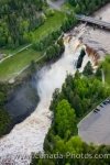
An aerial view of the Kakabeka Falls, aka Niagara of the North, in the wilderness of Kababeka Falls Provincial Park in Thunder Bay, Ontario in Canada.
Capturing an aerial picture of Kakabeka Falls Provincial Park, also known as the Niagara of the North, is spectacular as you can see how massive the falls are as the water crashes over the rock ledge, 40 meters down into the pool. The Kaministiquia River has carved its way thr ...
Trowbridge Island Lighthouse Lake Superior Thunder Bay
From the air, the scenery is amazing as you pass over Trowbridge Island and the lighthouse in the waters of Lake Superior in Thunder Bay, Ontario.
Trowbridge Island sits amongst other islands in Lake Superior, but this island marks the north side entrance to Thunder Bay in Ontario, Canada. Rugged rocky cliffs border the island and on the top, the Trowbridge Island Lighthouse, built in 1910, stands 37 fee ...
Helicopter Controls Southern Labrador
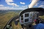
As a pilot flies this helicopter above Southern Labrador, Canada, you get a good look at the controls inside and the beautiful scenery below.
While flying in this helicopter, we can see for miles across the landscape of Southern Labrador, Canada but we also get a great look at the modernized controls inside the helicopter. Each one of the controls has a purpose and the experienced pilo ...
Aerial River Picture Southern Labrador Canada
Enroute to the Mealy Mountains in Southern Labrador, Canada we get a beautiful aerial picture of a river meandering its way around the landscape.
Aboard a helicopter enroute to the Mealy Mountains in Southern Labrador, Canada, the scenery below is stunning as we capture this aerial picture of a river veering off in different directions around the landscape. The dense forest is dark green w ...
Single Iceberg Aerial Southern Labrador
An aerial view of one single iceberg that remains in the bay along the coast of Southern Labrador near the town Charlottetown.
While touring above the bay near the town of Charlottetown in Southern Labrador, Canada, this aerial shot gives us the view of a single iceberg. The rest of the area seems to be free of any icebergs, but this particular one is still hanging on ev ...
Rifflin Hitch Lodge Aerial Southern Labrador
A scenic aerial view of the wilderness that surrounds the Rifflin'Hitch Lodge in Southern Labrador, Newfoundland Labrador in Canada.
An aerial view of the Rifflin'Hitch Lodge in Southern Labrador lets one see what a prime location this fishing lodge has. The Eagle River runs alongside the lodge with the rest of the area consisting of lush green wilderness.Aerial view of Riffli ...
Belle Isle Strait Iceberg Aerial Southern Labrador
An aerial view of an iceberg melting in the Strait of Belle Isle in Southern Labrador in Newfoundland Labrador, Canada.
An aerial view of an iceberg shows you the massive size of the base under the surface of the ocean's ripples that still has a way to go before being completely thawed. This iceberg floats around the Strait of Belle Isle in Southern Labrador, Cana ...
Newfoundland Town Aerial Gros Morne National Park
An aerial view of a small town situated along the water's edge in Gros Morne National Park in Newfoundland, Canada.
An aerial view of a section of Gros Morne National Park in Newfoundland, Canada where a small town weaves its way along the coastline. This town is one that you could drive around and explore in an afternoon as you can see from this aerial shot t ...
Rainbow Fog Aerial Southern Labrador
As the helicopter tries to capture an aerial view of the Southern Labrador coastline, a rainbow coloured halo is clearly visible in the fog bank.
Flying above Southern Labrador on a helicopter tour, the coastline comes into view occasionally between the thick patches of fog. This aerial picture is rather unique as you can see a rainbow coloured halo amongst the fog with the shadow of the h ...
Kluane Lake Aerial Yukon
An aerial shot of Kluane Lake in the Yukon Territory in Canada with the sun sparkling off the water's surface.
The water of Kluane Lake in Kluane National Park in the Yukon Territories swirls in and around the sandy landscape that makes up the bottom of the lake. An aerial view of the lake lets you see the entire area and the patterns that are formed from ...
Iceberg Tip Aerial Southern Labrador
An aerial shot of an iceberg over the Strait of Belle Isle in Southern Labrador is a unique way to see these natural wonders as the tip of the iceberg is much smaller than the base.
An aerial view of an iceberg lets you see how massive the base of an iceberg can be while what is left of the tip slowly breaks away into the surrounding water. Small pieces from the iceberg float away and once the entire tip melts, boaters aroun ...
Parry Sound Waterfront Aerial Ontario Canada
An aerial view of the buildings, boats and docks that line the waterfront of Parry Sound, part of the 30,000 Islands in Ontario, Canada.
Flying above Parry Sound in Ontario, Canada the aerial view is spectacular as you can see the busy waterfront where boats arrive and depart as well as all the buildings and houses across the landscape. It is amazing to see the 30,000 Islands from ...

